The d’Arcy Dalton Way Across the Oxfordshire Cotswolds and Thames Valley
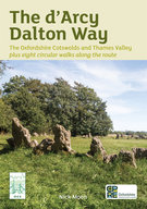 This newly revised edition of Nick Moon’s guide to the route is an essential companion to anyone walking all or stages of the 52 miles which pass through almost wholly unspoilt countryside, taking in tranquil and little known villages with much wildlife to be enjoyed along the way. The book includes eight circular walks and is available from the CPRE or bookshops.
 Oxford, the Downs and the Thames Valley-
This second book of the series covers walks around Oxford and in the southern part of Oxfordshire in a similar style to the first book. It includes walks in the Downs and along the Thames Valley.
 Written by Elaine Steane (OFS member), this book is about The Seven Shires Way. Unlike other walking guides, this newly revised (2023) edition leads the walker through a richly illustrated mixture of local landscapes of the popular long distance footpath around the 234 miles of Oxfordshire’s county boundary. It has been updated to include many new features: footpath and road changes; archaeological detail, such as vernacular buildings; lists and shows flora from open downland to ancient woodland.
The Roman Way
 Written by Elaine Steane, “The Roman Way” is a 174-mile walk, on the theme of Roman roads, using public rights of way. It follows a triangle formed by three Roman roads from Chesterton, near Bicester in Oxfordshire, to Cirencester in Gloucestershire, and on to the Roman walled town of Silchester in Hampshire, returning to the Roman military fort at Alchester near the starting point. The route follows Akeman Street as it crosses the limestone heights of the Cotswold Hills to Cirencester, then south-
Milestones to Millstones
 Written by Elaine Steane, this book describes 17 circular walks exploring mills and the surrounding landscape in Oxfordshire and just beyond.
The walks feature the following mills: Ardington, Ascott-